|
|
Finding the entrance to this lovely park is somewhat tricky. As you enter, there is a small sign that reads, “Town of Southampton Red Creek Park.” However, since it is facing the opposite direction, what you see instead is a sign reading, “Animal Shelter.” I’ll give you detailed directions to find the park entrance at the end of this article. Once you are on the road in the park, go past the picnic areas; after the stop sign to the right of the Animal Shelter you will see the parking field.
There are pay phones, restrooms, and water available near the parking area. A wide range of facilities is available in this park: playground; dog walk routes; picnic area; ball fields; places for roller blading and skateboarding; and tennis, basketball and volleyball courts. Parking is free, but there are fees and regulations for many of the activities, so I suggest you call before you make your visit.
Park by the brown and yellow Southampton Town Trail sign next to a basketball court to the right, and a baseball diamond to the left. 200 feet north beyond the baseball field fence is where the trail begins. There are square yellow STPS “Owl Blazes” to mark the access trail to the Blue Owl Loop. At the entrance of the trail is a box with maps; you may take one. These maps are based on an earlier blazing system developed by Scout volunteers. The blazes are almost all faded, but most of the trails are still there. If you feel adventurous, you can try to follow them.
|
|
Southampton Trails Preservation Society has a map of Hubbard and Sears Bellows County Parks, and Red Creek Town Park that shows this loop trail. If you are interested in purchasing the map (or helping with trail work) call STPS at . There is a nice selection of loop trails in Southampton, thanks to the almost superhuman efforts of a few dedicated trail maintainers. I help these guys, but not nearly as often as I’d like to. This is why I felt particularly angry when I realized that some pea-brained yahoo had made their job even harder by pulling many of the yellow owl blazes off the trees. One of us will now have to go in and nail up replacement owl blazes and that will take time away from doing more work on the Paumanok Path.
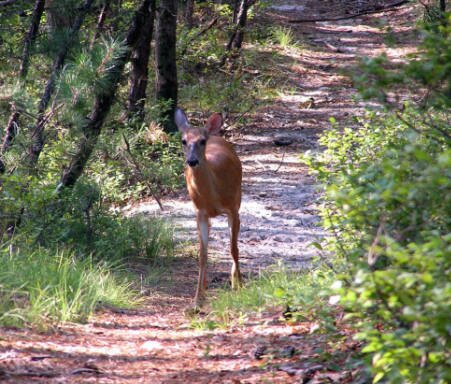
Where the trail splits, the left branch is an exercise path with places to do pull ups, sit- ups, and stretches. You need not worry about getting lost though; the two branches of the trail come back together and end up at Old Squires Road, an unpaved woods road occasionally used by cars. When you turn left onto the woods road, note another yellow and brown Southampton Town Trail sign; this is the landmark you will look for on your way back. Walk along this road until you reach Hildreth, another woods road. Turn right, and then a quick left takes you into the woods. Soon the blue loop co-aligns with the Paumanok Path marked with white painted rectangles. Cross back over Hildreth and pass two benches. Follow the Paumanok Path until you reach another bench and a post with the number 3 on it, and then turn right. As of this writing, there are few blazes along this portion of the loop. A young doe led the way to a post with the number 2 on it where I realized she was telling me to make a right turn. Pass a couple of vernal ponds on your left and at the fourth bench turn right, back onto Old Squires Road. This is where you look for the yellow and brown Southampton Town Trail sign. Turn left to head back to the parking lot. I estimate the entire walk is a smidge less than four miles.
Directions: Take Sunrise Highway to exit 65N (route 24) towards Riverhead. Travel north on C.R. 24 a couple hundred yards. You will see several signs before you bear right onto the turn lane for Old Riverhead Road West. There is not a Southampton Town Park sign here; the sign to look for is “Town of Southampton Jackson Ave. Offices,” and “Town Police.” Turn right onto Old Riverhead Road, pass the entrance to Southampton Town Police, and make the next left into the park.
|
